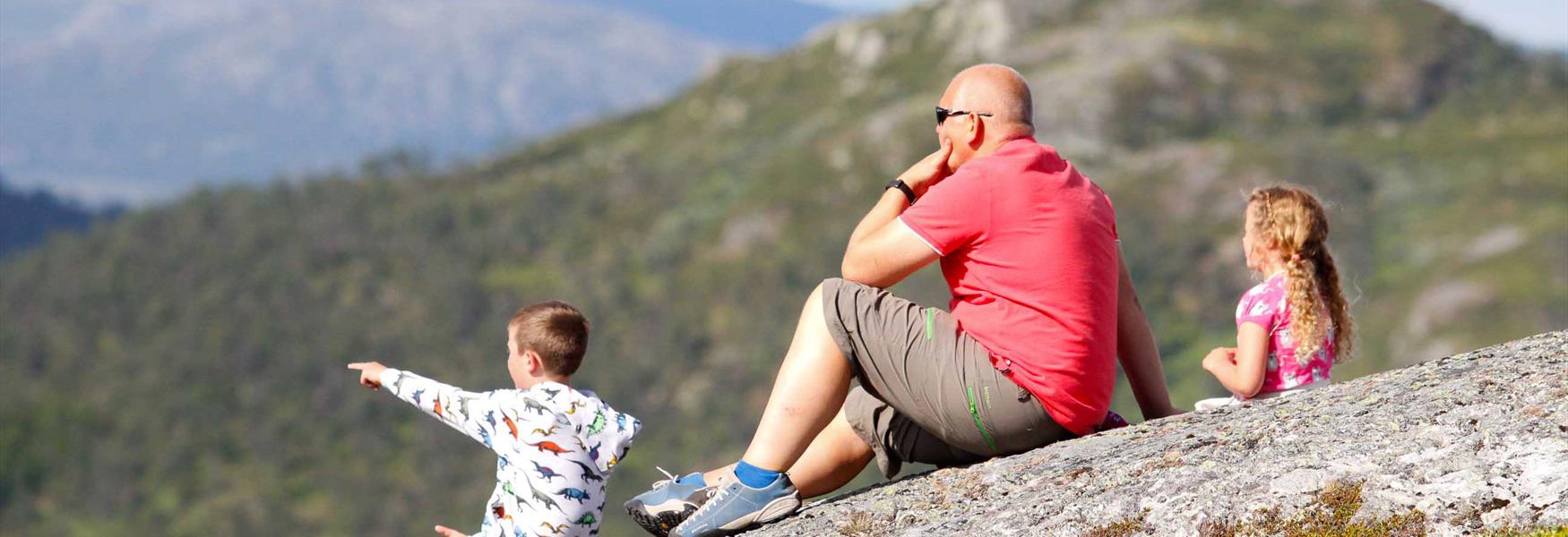
Explore Telemark
Telemark Mountain


To build your own Itinerary, click  to add an item to your Itinerary basket.
Already saved an Itinerary?


All hiking trails in HikingTelemark are well signposted, marked and graded in four different colors according to level of difficulty. Well marked trails makes it easy and safe to navigate. Here´s a brief introduction to the Norwegian grading system, to help you find the trip that best suits you and your tour mates:

The system consists of four color coded icons: green is easiest, blue is medium, red is challenging, and black is expert.
How demanding a trail is, is partly determined by the number of meters ascent and the length of the trip. The purpose of grading the trails is to create security and well-being among hikers.
Number of results: 33
, currently showing 1 to 20.
The trail starts at Vierli Kafeteria by the subway under the main road. Follow the marked trail to the top of Mount Vierlinuten (1,100 m above sea level).
Rauland
| medium |
|---|
| 2 hours |
|---|
| length in km | 4.5 km |
|---|
| mountain | |
|---|---|
| view |
Explore Rjukan on a 2.7 km easy city walk. Discover Måna River, the Lovers' Path, and UNESCO heritage. Family-friendly and stroller accessible.
Rjukan
| easy |
|---|
| 1 hour |
|---|
| length in km | 2.7 km |
|---|
| forest | |
|---|---|
| city |
Gaustatoppen – Norway’s most beautiful mountain. From Stavsro, follow the wide, well-marked red trail to the summit with views of Telemark, Buskerud, and Hardangervidda.
Rjukan
| challenging |
|---|
| 5 hours |
|---|
| length in km | 8.6 km |
|---|
| view | |
|---|---|
| stony |
Explore Helveteshylen in Dalen! A 9 km historic hike featuring a suspension bridge, logging history, and views of Bandak. See the giant brown trout.
Dalen
| medium |
|---|
| 3 hours |
|---|
| length in km | 9 km |
|---|
| forest | |
|---|---|
| river |
Hike the spectacular Lårdalstigen trail! Experience 14 km of rugged ridges, 800m drops, and a historic canal boat return. Plan your adventure in Dalen here.
Dalen
| challenging | |
|---|---|
| expert |
| 8 hours |
|---|
| length in km | 14 km |
|---|
| mountain | |
|---|---|
| steep |
Explore Oldemorstien (2.2 km) at Skinnarbu. A family-friendly, graveled loop from Hardangervidda National Park Centre with views of Lake Møsvatn.
Rjukan
Discover Røyrodden in Treungen! A family-friendly 5 km hike with beaches at Lake Nisser, 1,000-year-old oak trees, and historic Viking burial mounds.
Treungen
| medium |
|---|
| 2 hours |
|---|
| length in km | 5 km |
|---|
| beach | |
|---|---|
| cultural landscape |
Hike Roan (1191 m) in Fyresdal! A 10 km challenging trail offering stunning panoramic views of Gaustatoppen and Telemark. Get the full hiking guide here.
Fyresdal
| challenging |
|---|
| 5 hours |
|---|
| length in km | 10 km |
|---|
| mountainous terrain | |
|---|---|
| view |
Follow the "Rui Girls" trail in Dalen! Climb the 810 Sherpa steps to the historic Rui farm for stunning views. A unique cultural hike in Telemark, Norway.
Dalen
| challenging |
|---|
| 4 hours |
|---|
| length in km | 5.5 km |
|---|
| steep | |
|---|---|
| cultural landscape |
Hike Skuggenatten in Treungen! A 4.3 km challenging trail with stunning views of Lake Nisser. Perfect for adults and active families. Read more here!
Treungen
| challenging |
|---|
| 3 hours |
|---|
| length in km | 4.3 km |
|---|
| mountainous terrain | |
|---|---|
| view |
Hike Gygrestolen in Bø! A 7 km loop featuring dramatic cliffs, ancient legends, and panoramic views of Telemark. Discover trail info and safety tips here.
Bø i Telemark
| medium | |
|---|---|
| challenging |
| 3 hours |
|---|
| length in km |
|---|
| mountainous terrain | |
|---|---|
| cultural landscape |
A walk through beautiful landscape and Smorklepp Art Museum - Sorensen and Kihle. This is an easy walk in part of the Vinje cultural landscape.
Vinje
| medium |
|---|
| 2 hours |
|---|
| length in km | 4 km |
|---|
| forest | |
|---|---|
| waterfall |
Hike Tretopper’n at Lifjell! A family-friendly 5.5 km loop to three scenic peaks from Jønnbu. Experience stunning views and exciting trails for all ages.
Bø i Telemark
| medium |
|---|
| 2 hours |
|---|
| length in km | 5.5 km round trip |
|---|
| mountainous terrain | |
|---|---|
| view |
Hike Skorve in Seljord! A challenging 10 km trek featuring panoramic views and WWII plane wrecks. Discover dramatic history and epic peaks in Telemark.
Seljord
| expert |
|---|
| 5 hours | |
|---|---|
| 8 hours |
| length in km | 10 (14) km |
|---|
| mountain | |
|---|---|
| steep |
Hike the Saboteur Trail in Rjukan! Follow the WWII heroes' route to Vemork on an 8 km historic path. Discover the heavy water sabotage and epic views.
Rjukan
| medium |
|---|
| 3 hours |
|---|
| length in km | 8 km |
|---|
| hilly | |
|---|---|
| cultural landscape |
Hike Hægefjell in Nissedal! A majestic 11 km trek with stunning views over Lake Nisser. Explore one of Europe’s premier climbing and bouldering peaks.
Nissedal
| challenging |
|---|
| 4 hours |
|---|
| length in km | 11 km |
|---|
| mountain | |
|---|---|
| high mountain plateau |
Explore Bufjordstigen in Dalen! An easy family hike featuring the Soria Moria sauna, local history, fishing, and the "jungle" of Buøy. Plan your trip here.
Dalen
| easy |
|---|
| 1 hour |
|---|
| length in km | 3 km |
|---|
| river | |
|---|---|
| cultural landscape |
Explore Kvennavegen on Hardangervidda! An easy 1.9 km loop from Mogen with a boat trip, boardwalks, and roadless history. Perfect for the whole family.
Rauland
| easy |
|---|
| 1 hour |
|---|
| length in km | 1.9 km |
|---|
| national park | |
|---|---|
| gravel |
Discover Hanakamjuvet in Seljord! An easy 4 km family hike featuring waterfalls, deep gorges, and stunning views of Lake Nisser. Perfect for all ages.
Seljord
| medium |
|---|
| 2 hours |
|---|
| length in km | 4 km |
|---|
| gravel | |
|---|---|
| waterfall |
Hike the Sherpa steps at Falkeriset! A family-friendly 3 km trail in Rauland with panoramic views of Hardangervidda. Easy access and stunning nature.
Rauland
| medium |
|---|
| 1 hour |
|---|
| length in km | 3 km |
|---|
| mountain | |
|---|---|
| national park |
Ratings & Reviews
Powered By
![]()


© Visit Telemark 2026. Copyright