

Fyresdal - Roan
Type:Hiking
Hauggrend, 3870, Fyresdal

To build your own Itinerary, click  to add an item to your Itinerary basket.
Already saved an Itinerary?


Experience Roan, the second-highest mountain in Fyresdal and one of Telemark’s most rewarding hiking destinations. This demanding yet spectacular summit hike offers a 360-degree panorama stretching from Hardangervidda to Gaustatoppen.
Total distance: 10 km (round trip)
Elevation gain: 590 meters
Terrain: Challenging, featuring steep inclines and rocky sections
Duration: Approximately 4–5 hours depending on fitness level
To hike Roan, drive from Hauggrend in Fyresdal (FV 355).
The hike begins at the information board by the parking lot.
From the cairn at 1,191 meters, you are rewarded with one of Telemark's finest views. An orientation table on the summit helps you identify the surrounding peaks:
Tip: Don’t forget to sign the guestbook at the summit before returning along the same path to Røyningdalen.
To preserve the natural beauty of Fyresdal, please practice responsible hiking:
Safety Note: Always check the weather forecast before departing, as fog can settle quickly at this altitude.
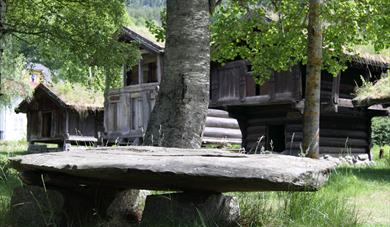
Fyresdal Open Air Museum is situated in Oyskogen (The Island Forest), which is an…
Folkestadbyen- The town of Folkestad.
In the 1870s, a centre for commerce and crafts…
What did a prosperous farm in West-Telemark look like about 200 years ago? At Kviteseid…
Kviteseid Old Church lies close to Kviteseid Bygdetun museum, on a beautiful plateau near…
Experience charming Kviteseidbyen by the Telemark Canal! Explore local cafes, shops and…
Here at Grimdalstunet you can get a glimpse into the home of the artist Anne Grimdalen. A…
Dalen Hotel is a beautiful fairytale hotel build in 1894 in grand romantic style with…
Fjoneferja i Nissedal, MF Nissen, transport passengers and cars, from Fjone to Framnes,…
Discover Eidsborg Stave Church! An 800-year-old cultural treasure, now dated to pre-1150!…
Is the storehouse of the legendary woman Åse Stålekleiv the oldest profane wooden…
Discover Vest-Telemark Museum! See Eidsborg Stave Church, Stålekleivloftet from 1184 and…
The Statkraft exhibit centre at the museum in Eidsborg tells the story of hydro power…
Våmur Viewpoint in Telemark, where steep mountain sides meet majestic Fyresvatn. Enjoy…
For about 1000 years Tokke has had an export industry of whetstones. For Norwegian…
 Fossumsanden Camping, FyresdalExperience nature camping at Fossumsanden in Fyresdal! Cozy cabins, glamping, and lakeside pitches. Enjoy the peace and our unique riverside sauna.
 Fyresdal Heritage walk, FyresdalA small “town” began to form in the centre of Fyresdal in the 1870s, what was known as Folkestadbyen.
Ratings & Reviews
Powered By
![]()

© Visit Telemark 2026. Copyright
