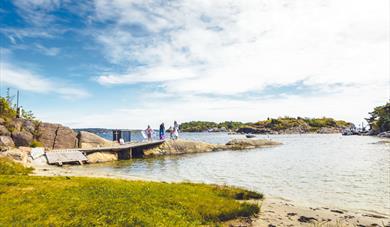
Map of the islands
Type:Island hopping
3950, Brevik


To build your own Itinerary, click  to add an item to your Itinerary basket.
Already saved an Itinerary?


Download the map of all the islands here and get a detailed overview of what facilities are on the different islands.
See the timetable for the ferries from Brevik.
See the timetable for the ferries from Helgeroa and Langesund
The timetables for the Summer season will be updated when they are ready.
The island jumping map will be distributed throughout Grenland in the following places:
- Service offices in the municipalities
- Skien Tourist Office, Langesund Tourist Service
- All hotels in Grenland
- the ferry office in Brevik
- On racks around the shopping center and NSB.
Please contact the Tourist office at Ph. + 47 90 55 20 if you need more information, or send us an email
At Rugtvedt in Bamble, a new exciting locality has emerged, a sandy beach that was…
Bamble is dominated by two types of landscape with completely different geological…
The Olav church ruin (Skeidi church) are the ruins of a stone church built before 1150 in…
Great hiking area near Rognstranda in Bamble. Beautiful forests and flora.
Bamble's Landscape - Exciting Geology Through Millions of Years
Langesund customs warehouse as it stands today was erected in 1869.
Tollpakkboden is a log-built warehouse, the main part of which dates from the early 1700s.
The old guardhouse is now a customs museum, with artefacts found there from long ago.
The landscape with the escarpments, "flauane" in Norwegian, is characteristic of the…
The rocks in Steinvika were created in the earth's antiquity, for approx. 461-451 million…
The history of Langøytangen lighthouse station dates back to 1828.
As the first geopark in Scandinavia, Gea Norvegica became member of the Global Geoparks…
The Gea Norvegica Geopark visitor center is located at the porcelain factory in Porsgrunn…
 How to behave in the nature, PorsgrunnRules for visiting the islands and how to behave towards nature and the environment.
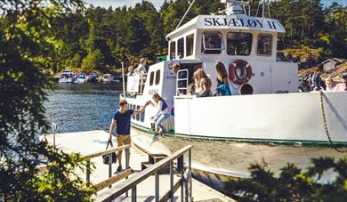 Timetable island hopping, PorsgrunnHere you will find information about timetables and prices for the Breviks ferries and the Helgeroa ferries.
Ratings & Reviews
Powered By
![]()


© Visit Telemark 2026. Copyright
