Trail around Stokkevannet
Type:Hiking
3960, Stathelle


To build your own Itinerary, click  to add an item to your Itinerary basket.
Already saved an Itinerary?


Stokkevannet is an idyllic water after the ice age was below sea level. It was in the 1800s large export of ice here and there has been water reservoir for both Brevik and Portrush. It is a species-rich and good fishing waters. The water is up to the steep Høgenhei plateau which is the border east of Kambrosilurfeltet.
Trail is generally easy to walk, but has some steep sections on the east side of the water.
If we start the tour by Rugtvedt and go south, we go in easy terrain along the water. It is fine for swimming and fishing opportunity already at the start. Later in the summer it can be somewhat overgrown along the water. Then one can alternatively follow walking / cycle track on the west side of E 18 By Svartorkjerr cross the E18 and follow the marked trail to the water. After a short way south, where summer pass large carpets of blooming lilies, it is recommended to take a short detour to the great and restored Tangvall mill.
We can then follow Tangvall way up and around a sharp right turn, and follow the path that goes right across the road. This was the old Tangvall Kleiva, previously only infrastructure to Portrush.
Trail now takes off to the north and follow the old post road from 1689 between Brevik and Kristiansand. Be sure to turn left a little way up the hill to get out to the magnificent lookout point at Hekkelsberg. Here is the set up tables and benches and is a good place for a picnic.
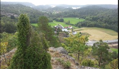
Trail continues further north on Høgenhei plateau in hilly terrain and cozy. Several places have nice views of the water and the land around it.
As we approach Høgenheitoppn becomes something more rugged, but this is soon forgotten when we come to the viewpoint at the top. It is also well worth taking a stop and admire the panoramic views. Be careful, especially if you have children and the terrain is smooth.
Around Høgenhei top is made several archaeological finds, with barrows and possible fort.
Few of Høgenhei top, the trail quite steep down a rocky path, but if one is careful going it is still okay.
At the bottom of the hill we go a little further along the road, which was formerly the Southern Norwegian highway "Highway 40". Here it is well hidden remains of a Oldtidsveien "covert" and German gunner positions from 1943 to 1944.
Now just follow the asphalt road and the path back to the starting point.
 Bamble, Bamble
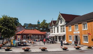
 Stathelle, BambleStathelle lies by the Brevik Brigde and has long been a junction between Bamble and Brevik because of the ferry traffic. Nice place to just walk around in the small streets with old houses.
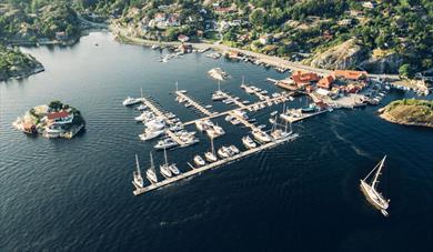
 Langesund, BambleLangesund has the most sunny days of all of Norway´s coastal towns and teems with visitors from May to August. At this time the town´s cultural life blossoms, with concerts and festivals.
 Valle, BambleValle, a gem of the archipelago with wealth of facilities, is located in the far south of Bamble.
 Oldtidsveien trail, BambleMost of the route follows the prehistoric road through good, easy terrain.
Ratings & Reviews
Powered By
![]()


© Visit Telemark 2026. Copyright